I recently expanded the River Level Text Service to cover the entire United States and a few rivers in BC. You can now get real-time streamflow information for over 10,000 gauges by simply sending a text message from your phone. Gauge sources include the USGS, USBR, WA Dept. of Ecology, Dreamflows, CO Division of Water Resources, Environment Canada, and many others.
How to use it: The number is
41411.
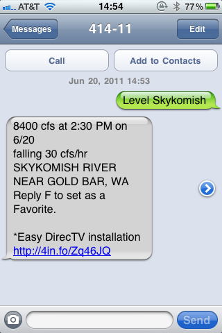
Text the word "Level" followed by the name of the river. Here are some examples: Level Skykomish, Level Robe, Level MF Nook, Level LW
How it works: As soon as the River Level Text Service receives your text, it contacts the gauge source to get the most recent level, converts it to a text message, and sends the info back to you. Depending on the gauge source and network traffic, this can take between 10 seconds and 2 minutes.
What you get back: Here's an example response for "Level Robe":
6.19 ft at 9:15 PM on 6/18
rising 0.08 ft/hr
SF STILLAGUAMISH RIVER NEAR GRANITE FALLS, WA
Reply F to set as a Favorite.
You can try it out here:
http://www.riverlevels.usIt knows lots of shortcuts: I designed the service to save on thumbtyping. So you don't need to type "North Fork Nooksack", just type "NF Nook". It also knows lots of paddler nicknames, so you can type "Level Ernies" and "Level FITW". If you have The River Gypsies Guide to North America, you can send any reach number. For example type "Level 41" for the Ohanapecosh (Cowlitz at Packwood). More shortcut examples are available on the FAQ page here:
http://www.riverlevels.us/FAQ.aspx
You can save your favorites: More thumbtyping savings. You can reply "F" to any level to save that gauge as a favorite. You can save up to 3 favorites. Then text "Level Favs" to get levels for all 3 of your favorite rivers back at once.
What if there are multiple gauges on a river: The River Level Text Service tries to give you the info for most common whitewater section. So for example, "Level Green" returns the Green River below Howard Hanson Dam. But for rivers where multiple gauges are commonly used, the service returns a multiple choice list. For example, "Level Wenatchee" returns a multiple choice list that includes Plain, Peshastin, and Monitor.
What if I want a different gauge on the same river: If the river name doesn't return the gauge you want, try sending the full name of the river. For example, "Level Green" returns the Green River below Howard Hanson Dam because this is the most common whitewater section. But if you want a different gauge on the Green, send "Level Green River". This will return a multiple choice list of all gauges on all Green Rivers in the US. If you want to narrow this down a bit, you can send "Level Green River WA". And if you know the specific gauge you want, you can send "Level Green Auburn" for example.
What does it cost: The service is FREE. But depending on your cell plan, you may have to pay to send and receive text messages. Also, my service provider puts ads at the end of the messages.
Find a problem or have a suggestion? Let me know! I'm adding features, gauge sources, and paddler nicknames all the time, so let me know if you find anything that needs improving. The best way is to email: support at riverlevels dot us.
 Active Topics
 Memberlist
 Search


 IP Logged